Instop Leica Geosystems Hexagon
buscar
equipos ocasion leica


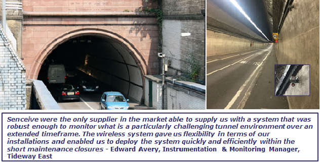
Monitorización de Deformaciones - Túnel Rotherhithe


Challenge


The Thames Tideway Tunnel will provide capture, storage and movement of almost all the sewage and rainwater discharges that currently overflow into the river Thames from central London. The Rotherhithe Tunnel sits in close proximity to the Tideway East shaft site.

CVB (Costain, VINCI Construction Grands Projets and Bachy Soletanche), along with Sixense as their appointed monitoring contractor, required a monitoring system 12 months ahead of impacting works, to provide a sufficient period of baseline monitoring and continuing until any movements associated with the works have ceased.

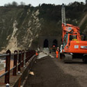
Access was only allowed during night-time engineering closures that took take place once per week. Another challenge was that the majority of the tunnel lining is tiled and is very delicate and as such, TfL were reluctant to allow fixings into it. Every two weeks a machine, which combines a spinning brush and high pressure hot water jet, runs through the tunnel in order to clean this tunnel lining. Therefore, any system had to be robust enough to survive the twice monthly tunnel cleaning.

Solution


Senceive provided their wireless FlatMesh™ system as a monitoring solution. 74 high precision tilt sensor nodes were installed by Sixense during engineering closures over an 8 week period to monitor any convergence/ divergence during the works.

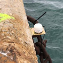
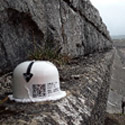
64 of the nodes were installed directly onto the tunnel lining in 16 arrays of 4 nodes per array. A further 10 nodes were mounted on 3m beams in a vertical shaft. The FlatMesh™ system allowed all the nodes to communicate with each other and measure sub-mm movements for an estimated project duration of 3-5 years.

The data is received by two wall-mounted 3G gateways, positioned and powered at the base and top access chamber of Shaft 3 with the data being relayed and transmitted via an antenna at the top of this shaft. This secure data was then easily sent through the mobile GSM network and accessed by registered users of the Senceive WebMonitor data visualisation software and the client’s own software. The nodes could also be remotely configured to provide near real-time data frequency if required.


Sectores de aplicación de los sensores de Senceive y Omnidots

Ferrocarril auscultacion monitoring

Auscultación vía ferrea

Auscultación de superestructura o vía; peralte, alaveo y perfil longitudinal. Monitoreo de infraestructura. Convergencias, deformaciones y subsidencias en túneles y puentes
control de taludes con sensores

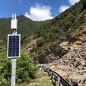
Monitorización de taludes

Alerta temprana de movimientos y desprendimientos
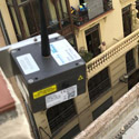
 

auscultación para edificiación y excavaciones

Auscultación de edificios

Auscultación de superestructura o vía; peralte, alaveo y perfil longitudinal. Monitoreo de infraestructura. Convergencias, deformaciones y subsidencias en túneles y puentes
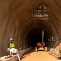
Monitoreo de túneles

Monitoreo de túneles

Convergencias
Asentamientos


monitoring puentes

Auscultación de puentes

Monitoreo y auscultación de puentes
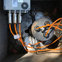
Topógrafos

Geotecnia

Excavaciones profundas, auscultación y monitoreo, movimientos del suelo y subsuelo, automatización de instrumentación geotécnica; inclinómetros, IPI, piezómetros, células de carga, extensómetros
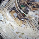
 

Auscultación en minas

Auscultación de minas

Monitoreo y auscultación de minas a cielo abierto o subterraneas
carreteras monitoreo

Auscultación de carreteras

Control de taludes, firme, tuneles en tiempo real


Patrimonio auscultación de edificios historicos

Patrimonio

Monitorización obra de fábrica para predicción y mantenimiento de edificios y estructuras
Ingenieria civil

Ingeniería civil

Auscultación y monitorización de estructuras, puentes, túneles, pantallas, muros, vuelcos, convergencias, perfiles longitudinales y verticales, cargas, tensiones, pruebas de carga


auscultacion infraestructuras especiales

Infraestructuras especiales

Auscultación de superestructura o vía; peralte, alaveo y perfil longitudinal. Monitoreo de infraestructura. Convergencias, deformaciones y subsidencias en túneles y puentes
Topógrafos

Auscultación en topografía

Las nuevas oportunidades del topógrafo en la auscultación y monitorización por sensores


Energía monitoring

Energía

Monitoreo y auscultación de presas, oleoductos, parques eólicos, chimeneas, estabilidad, deformaciones, presión, tensión, pruebas de carga


Atención Cliente: +34 93 803 95 76

instop responsive


instop nuestras oficinas


Los pedidos realizados

hasta las 18:00 horas*
se entregarán en 24h**
* En España y Portugal se entregarán al día siguiente. En el resto del mundo entre 5-7 días laborables
** Sujeto a la disponibilidad


Alquiler Instop
Tarifas Instop

control maquinaria leica
Control maquinaria
3d reality capture
Reality Capture
senceive y omindots
Auscultación
Piezas especiales instop
Piezas especiales
senceive ferrocarril
SAT Instop leica
youtube instoplinkedin instopnovedades instopfacebook instoptwitter instopinstagram instop
instop primeras marcas en topografia