Instop Leica Geosystems Hexagon
buscar
equipos ocasion leica


Embankment Monitoring: Hamm Railway


Challenge


The Dortmund to Münster railway line is one of Germany’s major train lines. During the end of 2018 a major fissure appeared along a 100m stretch of embankment, which ran parallel to the rail line. There was much concern and it was deemed necessary to deploy an emergency monitoring system to investigate further, eliminate potential risk and prevent any interference with the busy train line.
Due to Senceive’s pedigree in providing monitoring solutions for both slopes and track bed within the rail industry throughout Europe and beyond, Deutsche Bahn selected Senceive’s FlatMesh® system to monitor at-risk areas once the fissure had been filled in. This smart wireless system can be easily deployed in a matter of hours and allows the rail maintainer to see the relationship between slope and track.


Solution


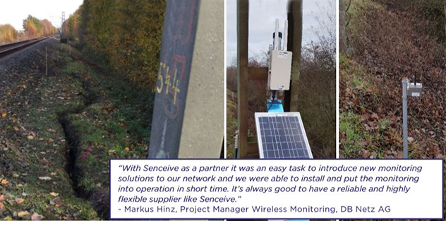
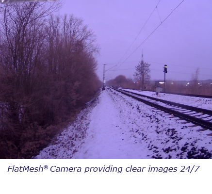
To better understand and manage the impact of any potential slope movement to the track, Senceive sent an emergency track monitoring kit, consisting of 34 triaxial tilt sensors and a FlatMesh® gateway to measure sub-mm movements, which can be deployed in a matter of minutes if required. For the main investigation 3km embankment were monitored using a total of 233 stake-mounted triaxial tilt nodes, arranged in two offset rows at approx. 25m intervals. A FlatMesh® camera was also deployed to give clear still shots 24/7 of the main area that had the filled in fissure. This would be triggered upon significant movement.
The wireless sensors were all able to communicate with 7 solar powered gateways, which then transmitted secure data to the WebMonitor visualisation software, which can then be accessed online by registered users.


Outcome


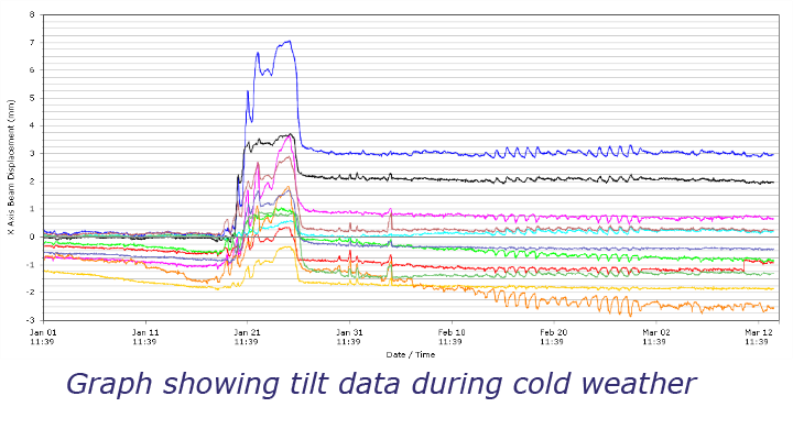
During the late winter period, up to 9mm of movement was detected by multiple sensor nodes in the at-risk area during a one-week period, before returning back to the baseline. The FlatMesh® camera images could easily be accessed remotely and clearly showed that the area experienced snow during this time, which indicates that the movement was caused by extreme variations in temperature causing the ground to contract/expand.
This precise data and accompanying visuals corroborate the hypothesis that the fissure, and original movement that caused it, was due to de-vegetation of a local field which impacted the soil moisture levels near the rail line. This was then further influenced and exacerbated by seasonal changes such as the snow in winter. The exceptional battery life of the nodes, of 12-15 years, offers the flexibility for the monitoring duration to be extended to further investigate the seasonal impact on the slope movement and the emergency track bed monitoring kit is on hand in the event of movement relating to slippage which might impact the rail line.


Sectores de aplicación de los sensores de Senceive y Omnidots
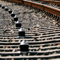

Ferrocarril auscultacion monitoring

Auscultación vía ferrea

Auscultación de superestructura o vía; peralte, alaveo y perfil longitudinal. Monitoreo de infraestructura. Convergencias, deformaciones y subsidencias en túneles y puentes
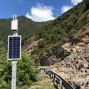
control de taludes con sensores

Monitorización de taludes

Alerta temprana de movimientos y desprendimientos
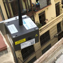
 

auscultación para edificiación y excavaciones

Auscultación de edificios

Auscultación de superestructura o vía; peralte, alaveo y perfil longitudinal. Monitoreo de infraestructura. Convergencias, deformaciones y subsidencias en túneles y puentes
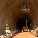
Monitoreo de túneles

Monitoreo de túneles

Convergencias
Asentamientos
 

monitoring puentes

Auscultación de puentes

Monitoreo y auscultación de puentes
Topógrafos

Geotecnia

Excavaciones profundas, auscultación y monitoreo, movimientos del suelo y subsuelo, automatización de instrumentación geotécnica; inclinómetros, IPI, piezómetros, células de carga, extensómetros
 

Auscultación en minas

Auscultación de minas

Monitoreo y auscultación de minas a cielo abierto o subterraneas
carreteras monitoreo

Auscultación de carreteras

Control de taludes, firme, tuneles en tiempo real


Patrimonio auscultación de edificios historicos

Patrimonio

Monitorización obra de fábrica para predicción y mantenimiento de edificios y estructuras
Ingenieria civil

Ingeniería civil

Auscultación y monitorización de estructuras, puentes, túneles, pantallas, muros, vuelcos, convergencias, perfiles longitudinales y verticales, cargas, tensiones, pruebas de carga


auscultacion infraestructuras especiales

Infraestructuras especiales

Auscultación de superestructura o vía; peralte, alaveo y perfil longitudinal. Monitoreo de infraestructura. Convergencias, deformaciones y subsidencias en túneles y puentes
Topógrafos

Auscultación en topografía

Las nuevas oportunidades del topógrafo en la auscultación y monitorización por sensores


Energía monitoring

Energía

Monitoreo y auscultación de presas, oleoductos, parques eólicos, chimeneas, estabilidad, deformaciones, presión, tensión, pruebas de carga


Atención Cliente: +34 93 803 95 76

instop responsive


instop nuestras oficinas


Los pedidos realizados

hasta las 18:00 horas*
se entregarán en 24h**
* En España y Portugal se entregarán al día siguiente. En el resto del mundo entre 5-7 días laborables
** Sujeto a la disponibilidad


Alquiler Instop
Tarifas Instop

control maquinaria leica
Control maquinaria
3d reality capture
Reality Capture
senceive y omindots
Auscultación
Piezas especiales instop
Piezas especiales
senceive ferrocarril
SAT Instop leica
youtube instoplinkedin instopnovedades instopfacebook instoptwitter instopinstagram instop novedades y ofertas
instop primeras marcas en topografia